 PetroStrategies, Inc.� PetroStrategies, Inc.�
|
||||||||||||||||||||||||||||||||||||||||||||||||||||||||||||||||||||||||||||||||||||||||||||||||||||||||||||||||||
|
||||||||||||||||||||||||||||||||||||||||||||||||||||||||||||||||||||||||||||||||||||||||||||||||||||||||||||||||||
ExplorationWhere do Fossil Fuels Come From?
There are two theories about how crude oil and natural gas were formed. Some scientists believe that petroleum is the result of the decomposition of plants and animals, while others suggest that decaying plants and animals had nothing to do with it. Organic TheoryThe organic theory says that oil and gas were formed from the remains of plants and animals. Scientists, who support this theory, think that oil and gas were formed from the remains of small or microscopic plants and animals that lived in prehistoric rivers and seas. When these plants and animals died they combined with mud, silt, and sand to form layers of the mixture called sediments. After thousands of years, a thick layer of sediment formed on the bottom of the sea. As more layers were added the weight of the new layers applied pressure to the lower layers and turned them into sedimentary rock. Scientists believe that high heat and pressure, bacteria, chemical reactions, and other forces transformed these sediments into oil and gas. Inorganic TheoryOther scientists believe in the inorganic theory that says that oil and gas were produced during the formation of the solar system and the earth. The inorganic theory is often used to explain why oil and gas are found in unexpected places and differences in chemical composition. The Science of the Earth
Because they study earth, geologists are important in the search for mineral resources and petroleum. Geologists who are employed by oil companies to determine whether a region may produce oil or gas are called petroleum geologists.
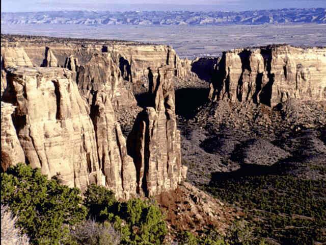
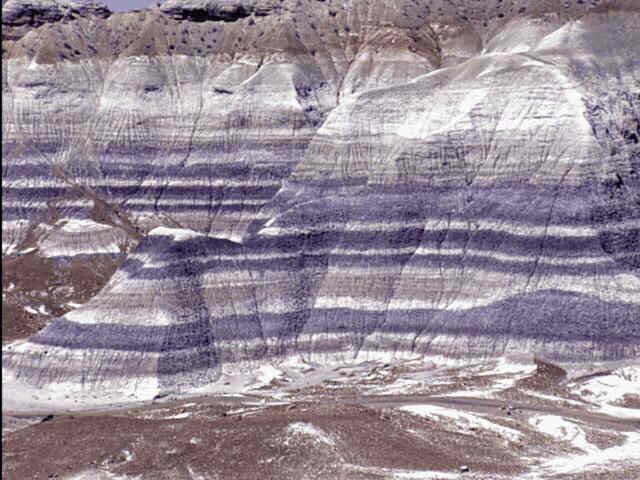
Where do We Find Oil and Gas?Unfortunately oil and gas do not exist is liquid pools underneath the earth's surface. In fact, you could hold a rock containing oil in your hand and would not be able to see the oil. Important Properties of Rocks
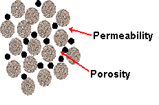
Scientists measure the amount of pore space by determining the rock's porosity. Porosity is expressed as the volume percent of the rock that contains open space and can range from 5 to 30%.
The greater the porosity, the more oil and gas can be stored in the rock. Porosity does not mean that there is oil or gas in the the rocks. In fact the pores could be filled with water. Not only must the rocks have pores, the pores must be connected so that the oil and gas can move through the rock. Scientists measure the ability of oil and gas to move through rock by determining its permeablity. Oil and gas in low permeability rock have difficulty moving out of the rock and into a well. Permeability is measured in thousandths of a darcy or millidarcys. Sandstone and carbonate rocks are generally the most porous and permeable rocks and are therefore where scientists usually find oil and gas. � How Does Oil Collect Under the Earth's Surface
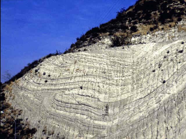
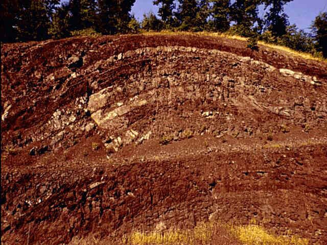
However, if we put the sponge in a plastic container, the water will stop dripping and will be trapped. Oil and gas will move toward the surface until they reached a barrier. Scientists call these barriers that hold oil and gas traps. A trap prevents oil and gas from rising to the earth's surface. A trap consists of a layer of rock that oil and gas cannot penetrate (impermeable) above a porous, permeable layer that holds the oil and gas. These traps can take many forms but a common type would be in the shape of an inverted bowl formed from impermeable rock. Traps are formed by changes in the earth's crust such as folding or faulting. Scientists categorize traps by how they were formed or how they look. The major types of traps are anticlinal, fault, plug, stratigraphic, and lenticular.
A fault trap is formed by a shift or movement of rock layers that caused an impermeable layer to create a barrier next to a layer of porous rocks containing hydrocarbons. Plug traps are traps where a core of impermeable rock has moved through layers of rock to form a trap.� These plugs are often composed of salt and salt domes are an important formation that scientists look for when trying to find oil and gas. A stratigraphic trap is created by either an impermeable rock layer over the top of a porous rock layer or by a change of porosity and permeability within the reservoir itself. Lenticular traps are formed by a change of permeability within the formation. These changes in the amount of connected pore space can create hydrocarbon pockets within a formation. The different trapping mechanisms can also occur in combination.
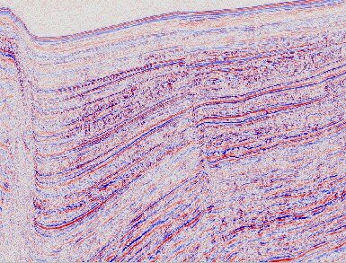
How Do Scientists Find Oil and Gas?It would be nice if scientists had some magical x-ray equipment that would let them look under the earth's surface to locate oil and gas reservoirs. Unfortunately this technology is not yet available and so scientists use other techniques to try to develop a picture of the underground rock layers and crude oil and natural gas deposits. Seismology
Energy is directed into the surface and passes through some layers and is reflected off of layers at different depths. This energy returns to the surface at different angles and with different energy levels.� The path the energy takes will be different depending on the shape of the surface it hits and the density of the surface. The energy is in the form of sound waves. The concept is similar to dropping a ball on a surface. If the surface is flat the ball will bounce straight up. If the surface is curved the ball will return at an angle. If the ball is bounced on a flat concrete surface it will return to nearly the same height from which it was dropped. If the ball is dropped on the grass it may not return at all. In seismic surveys the energy is returned to surface with a specific set of properties. The first step in performing a seismic survey is to create energy directed into the surface. This energy is produced by small explosive charges, mechanical methods, or sound waves. In the past scientists placed small explosive charges at various locations on the surface to create sound waves. Today mechanical equipment is used to produce these sound waves. In one device a steel slab is dropped onto the surface to create the energy while another method generates low-frequency sound waves. The next step is to measure the energy that is returned from the earth's layers. Sensors on the earth's surface called geophones receive the reflected sound waves, translate them into electronic impulses, and send them to the seismograph. The seismograph amplifies and records the electrical signal and produces a picture or seismogram. The seismogram is a two-dimensional picture of the subsurface. It is generate a seismic section, which is a two-dimensional slice from the surface of the earth downward. This section is known as 2D seismic because it shows the width and depth. The information from a seismic survey indicates the types of rock, their relative depth, and whether a trap is present. The seismogram indicates the types of rock, relative depth, and the presence of structural traps. Scientists are now applying seismic technology to produce three-dimensional images of the earth's subsurface. Three-dimensional seismic or 3D seismic creates an image that includes length, width, and depth. Seismic crews obtain data on a 2 or 3 mile square of the earth's surface. Large, high-speed computers analyze the data and create a picture of the surface. Scientists can then take slices of this in a variety of directions to examine the formation.
This technique is also be used at different time periods to study the movements of hydrocarbons. This produces a 4D seismic history of the formation with time as the fourth dimension. Although explorationists usually use geophones on the surface of the earth to gather seismic data, they may also use them in an existing well. In this method, scientists lower geophones into the well and attach them to the wall at intervals of 20 to 100 feet. This method is useful to obtain information about the geological structures close to the well.
Classes �
�
Copyright 2000 � |
||||||||||||||||||||||||||||||||||||||||||||||||||||||||||||||||||||||||||||||||||||||||||||||||||||||||||||||||||
 Despite the popular beliefs that oil and gas came from dinosaurs, Tyrannosaurs Rex did not have a lot to do with forming fossil fuels.